Donate
Ongoing project · Uvira, South Kivu

GovCheck Climate Innovation: acting before the floods in Uvira

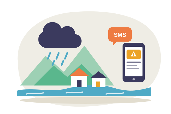
When heavy rain is coming, Uvira’s residents are warned by SMS; when they see a danger, they report it in their own language, and the City knows where to act. GovCheck Climate Innovation connects forecasts, residents and the City.

See the live toolGet rain alerts

A city on the front line

Uvira is home to over half a million people between deforested hills and Lake Tanganyika. In heavy rain, the bare slopes hold no water: the Kalimabenge, Mulongwe and Kavimvira rivers overflow.

  • 15,000 houses

    flooded or damaged by the Mulongwe flood on 16–17 April 2020; dozens killed and some 75,000 people left homeless.

    Uvira City Hall; AP, MONUSCO

  • 4,500 houses collapsed

    and 53 schools flooded in 2024, when the lake and rivers overflowed; more than 34,000 people displaced.

    Uvira City Hall, April 2024; AFP

  • 6 dead, 1,100 displaced

    in the Kalimabenge flood in Kalundu on 1 May 2026; 544 houses damaged and 7,800 people affected.

    Red Cross, IFRC (DREF MDRCD050)

Why Uvira is so exposed

Uvira stretches along a narrow strip between Lake Tanganyika and the Mitumba mountains, in three Municipalities: Kalundu, Kavimvira and Mulongwe. The slopes have been cleared, houses are built in river beds and on the lake shore, and drains are often blocked: every heavy rain turns into a flood. These floods have come back more and more often since the early 2000s; the one in 2002 already killed at least 46 people.

Climate change makes the risk worse: rain is more intense, and Lake Tanganyika has reached record levels since 2020. So does war: the occupation of the city by the AFC/M23, from December 2025 to 17 January 2026, displaced hundreds of thousands of people, who often settle where the water rises first.

Why the disaster keeps happening

  • Warnings come too late. Forecasts exist, but they do not reach residents of exposed neighbourhoods, in their language, on a basic phone, before the rain.
  • Reports get lost. Residents see blocked drains, cracks on slopes or rising water long before the flood, but do not know whom to tell, or whether anyone acted.
  • Language and phones exclude. Many speak Swahili rather than French, have no smartphone or internet, or cannot write easily.
  • The City lacks data. Without data, the City Hall and the Municipalities know neither where the water comes back, nor which drains fail first, nor whether the adaptation budget is spent.
  • No one is accountable. Residents cannot see who is responsible, how fast offices respond, or what happened to the money voted for drains, dykes and reforestation.

How GovCheck Climate Innovation works

GovCheck Climate Innovation is the climate module of GovCheck, CERC’s open-source civic platform, deployed for the City of Uvira and its three Municipalities. It connects forecasts, residents and the City, in four steps.

Before the rain: the alert

Every three hours, GovCheck reads the rain forecast (Open-Meteo). When heavy rain is coming – 30 mm or more a day –, every subscribed resident gets a free SMS alert, as do the Mayor, the Burgomasters and the offices concerned. The alert says what to do: keep away from rivers, never cross the water, move children and documents to a high place.

When someone sees a danger: the report

A resident sees a flood, erosion, a blocked drain or trees being cut? They report it by web, SMS or WhatsApp, in French, Swahili, Lingala or by voice. AI summarises, translates, flags urgency when homes or lives are at risk and sends it to the right office; an official checks. With a tracking code, the resident sees what the City does.

To prevent: the hotspot map

Put together, the reports show where the water comes back and which drains fail first, neighbourhood by neighbourhood and season after season. The City then knows where to clean, reinforce or replant before the next rainy season. Personal data and sensitive reports are never published.

To be accountable: public tracking

Each office has its scorecard: how many reports it resolves, how fast, and what residents think of it. The adaptation budget and its projects – drains, dykes, river banks, reforestation – are tracked from the vote to the payment. Everyone sees who responds and where the money goes.

An AI assistant also answers residents’ questions on alerts, prevention and procedures. It relies only on what the City has published; when it does not know, it says so.

What every household can do

An alert only protects people who know what to do. With each alert, GovCheck Climate Innovation recalls the right steps:

  • Keep the drain in front of your house clean; never throw waste into it.
  • During heavy rain, keep away from rivers, the lake shore and gullies; never cross flood water, on foot or by motorbike.
  • Move children, documents and valuables to a high place when an alert is announced.
  • Plant trees, bamboo or vetiver on slopes against erosion; do not build in river beds or on unstable slopes.

Responsible AI

AI helps; officials decide.

  • Officials validate every routing, urgency flag and publication: AI suggests, it does not decide. Each suggestion is kept with the model and the reason, so it can be checked.
  • The resident’s original words always stay beside the translation. Each month we will measure errors by language and neighbourhood, because AI understands Swahili and Lingala less well than French.
  • Residents are told when an answer comes from AI, and the assistant answers only from published information.
  • Personal data are never public, and our AI providers do not use them to train their models; the code is open source.
  • The tool is light: no model is trained, alerts rest on simple rain thresholds and pages work on a basic phone.

Where the project stands

  • Built and online

    Alerts, reports by web, SMS and WhatsApp, AI triage, map, scorecards, budget tracking and assistant: everything already runs on govcheck.cerc.cd.

  • Tested end to end

    A report written in Swahili was sorted, translated and routed automatically; SMS went out; WhatsApp and SMS conversations went through.

  • Ready for Uvira

    The City and its Municipalities of Kalundu, Kavimvira and Mulongwe are set up, with accounts for the Mayor, the Burgomasters and heads of service.

The 12-month pilot

It now has to be put in the hands of residents and officials. CERC is preparing a 12-month pilot with the City of Uvira; the proposed targets, to be confirmed with the City:

10,000residents subscribed to free SMS rain alerts

12 hof lead time at least for alerts before heavy rain

2,000climate reports received and routed, 70% of them taken in charge within 48 hours

160people trained: 100 municipal staff and 60 community relays

The pilot will also map the neighbourhoods at risk and, with this data, prepare a plan for cleaning drains and protecting river banks for the City Council. It will add flood-risk mapping from satellite images and river data, and speech recognition in Swahili and Lingala.

Scaling up

What works in Uvira can work elsewhere: GovCheck is open source, and a new City, Municipality, Sector or Chiefdom is added by simple configuration, without new code.

Year 1

Prove it in Uvira

The City and its three Municipalities; 10,000 residents subscribed to alerts; results measured and published.

Year 2

10 times more

About ten flood-prone entities in South Kivu and along Lake Tanganyika (Bukavu, Baraka, Fizi, Kalemie); 100,000 residents subscribed.

Year 3

100 times more

50 to 100 entities across the DR Congo and first deployments in neighbouring Great Lakes countries; one million residents reached by alerts.

GovCheck Climate Innovation contributes to the UN “Early Warnings for All” initiative, the Sendai Framework and Sustainable Development Goals 11, 13 and 16. It complies with the DRC Digital Code on personal data, and will align its alerts with those of METTELSAT and civil protection, to complement them rather than compete with them.

Join us

For the pilot to succeed and spread to other cities, we are looking for partners: to fund the pilot, SMS and training; to model flood risk and recognise speech in local languages; and to connect the tool with meteorological services, mobile operators, humanitarian actors and other African cities.

Write to us See the live tool